

 About the author: Nicholas Hudanich is a sophomore undergraduate at New York University, pursuing a major in Civil Engineering with a Transportation minor. Nick is a researcher and a part of the website/communications team at C2SMART. Nick has contributed to transit research projects such as the MTA Jay Street Accessible Stations Pilot, and the monthly COVID-19 Blog Posts. Nick is a transportation enthusiast with a goal of visiting as many subway stations as possible, and in his free time enjoys Geocaching, a GPS-coordinate-based global treasure hunt.
July 23, 2026 In July, NYU Tandon Professor Daniel Vignon,...
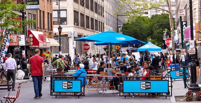
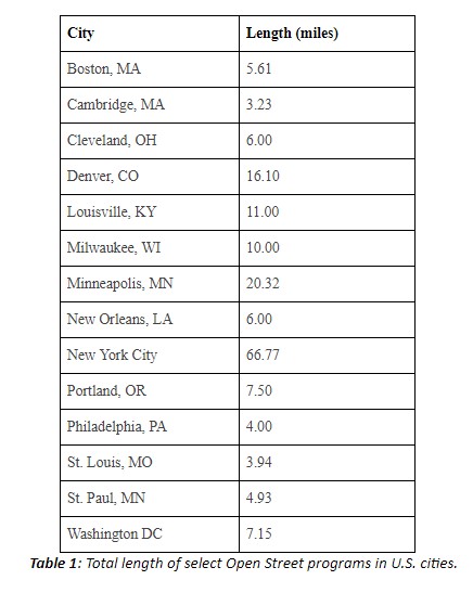
Read MoreCities around the globe are using the COVID-19 pandemic and resulting shelter-in-place orders to explore pedestrianizing streets. Strategies on which streets to open to communities and how to do so vary widely between municipalities. In some cities, busy streets considered too vital to close entirely are required to remove parking lanes to expand pedestrian space. A growing number of cities, including New York City, have developed plans to close parking lanes on several miles of street to provide more outdoor seating for adjacent restaurants and cafes. Many cities have also provided extra space in front of grocery and large chain stores to give lines of customers room to distance themselves. Cities such as Burlington and Providence have reduced speed limits in large portions of their downtown areas, and specifically in Burlington, the new lower speed limit was implemented citywide to try to mitigate pedestrian fatalities. Seattle has reserved many of its core streets for “local traffic only”, reducing congestion within certain neighborhoods, and improving street safety in high-density residential areas.